ITM - Carte de Bolivie

| Destination | Amérique du sud |
|---|---|
| Pays / Région | Bolivie |
| Edition, collection | I.T.M (International Travel maps) |
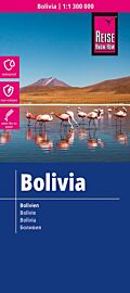
Une carte recto/verso au 1/1.400.000ème (1 cm = 14 km). En matière résistante
Détails de l'article
Voici comment l'éditeur présente ce titre sur son site :
Bolivia is one of the travel world’s better kept secrets. It is a land-locked large country straddling the Andes mountain chain, whose people largely live in the mountainous western half of the country. In the north, it shares Lake Titicaca (the largest lake in all of South America) with Peru. The capital city, La Paz, is at an altitude of just over 4,000 meters above sea level with Peru. The far north is largely an under-populated forest reserve, and the far east a series of national parks. The double-sided map shows the south half, with an inset of La Paz, on side 1, while side 2 concentrates on the north, with detailed inset maps of Potosi and Santa Cruz de la Sierra.
Legend Includes:
Roads by classification, Rivers and Lakes, National Park, Airports, Points of Interests, Highways, Main Roads, Zoos, Fishing, and much more...
(Source : ITM)