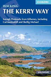
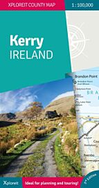
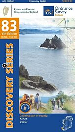
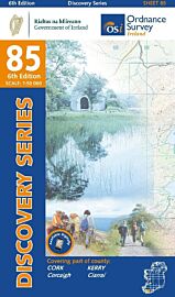
Ordnance Survey Irlande - Carte de randonnées - N°71 - Kerry (est)

| Destination | Europe |
|---|---|
| Pays / Région | Irlande |
| Edition, collection | Ordnance Survey |
Très bonne carte de randonnées au 1/50.000ème (1cm = 500 mètres). N'hésitez pas à nous demander pour passer commande d'autres cartes de la série
Détails de l'article
Voici comment l'éditeur présente ce titre sur son site :
OSI Discovery Sheet No. 71 covers County Kerry at a 1:50 000 scale and is designed for all sorts of leisure activities including walking, cycling and tourism.
Features shown on the Discovery series include walking trails, cycle routes, forest parks and nature reserves. There is also tourist information such as campsites/caravan parks, youth hostels, tourist information offices, picnic places, standing stones, battlefields, golf courses and viewpoints. Available as a paper, folded map.
Discoverer 1:50 000 scale
Every 2cm is 1km, to show key elements such as footpaths, minor roads, and tourist information
Be ready for anything!
Whether it’s a long hike, a cycling tour, or a driving holiday – Discoverer maps are the perfect companion
Topographic mapping
Highly detailed contour mapping highlighting variations in terrain and everything you would expect from a map
(Source : Ordnance Survey)