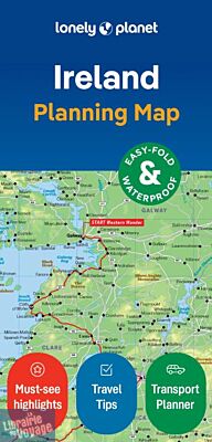
Lonely Planet - Carte (en anglais) - Ireland planning map (Irlande)
| Destination | Europe |
|---|---|
| Pays / Région | Irlande |
| Date de publication | 20 juin 2024 |
| Edition, collection | Lonely Planet |
Une carte très sommaire sur l'Irlande et des petites idées de visites présentées. En anglais.
Détails de l'article
Voici comment l'éditeur présente ce titre sur son site :
Durable and waterproof, with a handy slipcase and an easy-fold format, Lonely Planet's Ireland Planning Map is your essential navigation tool. This full-colour map features accompanying images
and information about top attractions, itinerary suggestions, a transport guide, themed lists and practical travel tips.
Durable and waterproof
Easy-fold format and convenient size
Handy slipcase
Full colour and easy to use
Before-you-go info
Beautiful imagery
Tailored itineraries
Can't-miss regional highlights
Detailed town index
Transport planner
Themed lists
COVERS
Dublin, County Wicklow, Enniskerry, Wicklow Mountains, Glendalough, County Meath, Brú na Bóinne, Cork, Ring of Kerry, Dingle, Cliffs of Moher, The Burren, Adare, Kilkenny, Rock of Cashel, Waterford City, Connemara, Galway City, Ennis, Killarney, Aran Islands, Donegal, Belfast, Causeway Coast, Derry City
(Source : Lonely Planet)