- Accueil
- Cartographie
- Cartes thématiques
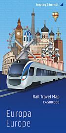
- Kummerly Frey - Carte - Railmap Europe (Carte des chemins de fer en Europe) - Le train en Europe
Kummerly Frey - Carte - Railmap Europe (Carte des chemins de fer en Europe) - Le train en Europe
| Destination | Europe |
|---|---|
| Edition, collection | Kummerly-Frey |
Une carte du réseau ferroviaire à travers l'Europe. On y trouve de nombreuses informations comme les lignes à grande vitesse, lignes electrifiées, des informations sur les pays, etc. La légende est en 6 langues dont le français
Détails de l'article
Voici comment l'éditeur présente ce titre sur son site :
Large physical map of Europe with political boundaries, showing the railway network graded into 18 different types of lines. The base map with very fine cartography clearly shows various mountain ranges. Coverage extends to beyond the Urals and the eastern side of the Caspian Sea, large part of the Middle East with most of Iraq and Iran, and the coast of North Africa, and includes railway lines in all these areas.
Country and geographical names are in English and cities in local languages with, where appropriate, English versions. In countries using other alphabets, larger cities are additionally given in Cyrillic, Greek, Arabic, etc.
The railway network distinguishes 18 different types of lines, from new high speed lines or upgraded high speed lines to narrow gauge electrified or non-electrified. Railway ferry lines, passenger or freight, are also marked.
Map legend is in English, German, French, Italian, Spanish and Russian. Also included is a panel with flags and details of area, population and the length of rail network for all European countries.
(Source : Kummerly Frey)


