Cicerone - Guide de randonnées (en anglais) - Hiking the Tour of Monte Rosa (Trekking the Swiss and Italian Alps from Zermatt)

| Destination | Europe |
|---|---|
| Pays / Région | Italie, Suisse |
| Région / Ville | Piémont / Val d'Aoste |
| Auteur | Maddy Williams |
| Date de publication | 1 mai 2025 |
| Edition, collection | Cicerone Editions |
Le Tour du Mont-Rose est très bien présenté dans ce guide en anglais
Détails de l'article
Voici comment l'éditeur présente ce titre sur son site :
Guidebook to the Tour of Monte Rosa (TMR), a 174km (108 mile) circular trek through the Swiss and Italian Alps. Presented in 11 stages with variants and two optional glacier crossings, the route includes several iconic alpine passes. With trek planning resources, an accommodation guide and 1:100,000 maps for each stage.
Seasons
With the trail going above 3000m on several occasions, this route is best from July to mid-September. Expect plenty of snow on the ground in June and early July. Some mountain huts are only open in late June, closing early September.
Centres
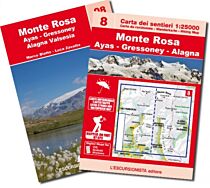
Zermatt, Grächen, Saas Fee in Switzerland. Gressoney/Stafal, Alagna and Macugnaga in Italy.
Difficulty
This is an excellent route for experienced trekkers. There are two optional glacier crossings requiring micro-spikes or crampons. There are a number of unavoidably long days, as well as several +1500m climbs. Waymarking is good throughout, but some paths can be challenging due to steep, exposed and unstable terrain, or if there is snow at high altitude.
Must See
Some of the most spectacular mountain scenery in the Alps, including 7 of the 10 highest Alpine peaks; the Swiss Europaweg; traditional Walser settlements; the 3rd longest suspension footbridge in the world; formidable alpine passes like the Turlo, Theodulpass and Monte Moro Pass; legendary high Alpine huts; two glacier crossings.
Described in 11 daily stages of between 7.5 and 22km (4.5–13.5 miles), with one alternative stage and two optional glacier crossings, the route includes several iconic alpine passes.
GPX files available to download
1:100,000 maps included for each stage
Handy route summary tables help you plan your itinerary
Refreshment and accommodation information given for each trek stage
Advice on planning and preparation
(Source : Cicerone)