Cicerone - Petit atlas de randonnées - West Highland Way map booklet
| Destination | Europe |
|---|---|
| Pays / Région | Ecosse |
| Région / Ville | Highlands et îles |
| Date de publication | 27 mai 2024 |
| Edition, collection | Cicerone Editions |
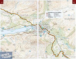
Un petit atlas qui viendra en complément d'un guide sur le West Highland Way. Les cartes de l'Ordnance Survey sont au 1/25.000ème (1cm = 250 mètres)
Détails de l'article
Voici comment l'éditeur présente ce titre sur son site :
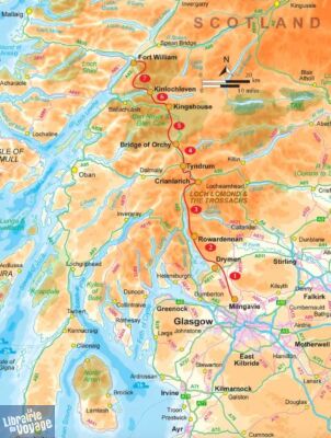
This compact booklet of maps shows the full route of the 95 mile West Highland Way, one of Scotland’s Great Trails. This booklet is included with the Cicerone guidebook to the trail and shows the full route on OS 1:25K maps. The map booklet can be used to walk the trail in either direction.
A booklet of all the mapping needed to walk the West Highland Way, one of Scotland’s Great Trails. Covering 155km (97 miles) from Milngavie to Fort William, the route is suitable for walkers of most abilities and takes around a week to complete.
The full route line is shown on 1:25,000 OS maps
The map booklet can be used to walk the trail in either direction
Sized to easily fit in a jacket pocket
The relevant extract from the OS Explorer map legend is included
An accompanying Cicerone guidebook – Walking the West Highland Way is also available, which includes a copy of this map booklet
(Source : Cicerone)


