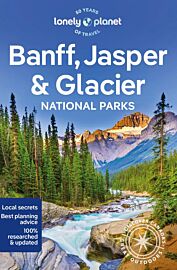
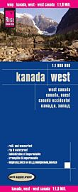
ITM - Carte de Banff et de Jasper (Rocheuses canadiennes)

| Destination | Amérique du nord |
|---|---|
| Pays / Région | Canada |
| Région / Ville | Ouest canadien |
| Edition, collection | I.T.M (International Travel maps) |
Une carte du parc de Banff au 1/240.000e (1cm représente 2,4km sur la carte) au verso et de Jasper au 1/250.000e (1cm équivaut à 2,5km sur la carte) au recto
Détails de l'article
Voici comment l'éditeur présente ce titre sur son site :
The great national parks of Banff and Jasper have long been enormous travel destinations within North America. The Canadian Rockies are more majestic than those of their southern cousins, and townsites like Lake Louise, Banff, and Jasper resonate with visitors in a way that more established townsites don’t seem to do. This is a double-sided map, with a double-sided cover, so can be displayed either with the Banff side facing outwards or the Jasper side. Either way, this is a marvelous map, offering both national parks for one price in excellent detail, showing camping spots, hiking trails, scenic attractions, and areas of accommodation. The map includes an excellent inset map of Banff, the only real town inside the parks, and more basic ones of Leak Louise and Jasper. Try swimming at the sulphuric-laced hot springs pool high above Banff!
Legend Includes:
Roads by classification, Rivers and Lakes, National Park, Airports, Points of Interests, Highways, Main Roads, Zoos, Fishing, and much more...
(Source : ITM)