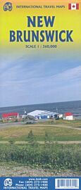
ITM - Carte des provinces maritimes canadiennes (Nova Scotia, New Brunswick, and Prince Edward Island)

| Destination | Amérique du nord |
|---|---|
| Pays / Région | Canada |
| Région / Ville | Provinces atlantiques |
| Edition, collection | I.T.M (International Travel maps) |
Une carte recto-verso au 1/535.000ème (1 cm = 5.35 km)
Détails de l'article
Voici comment l'éditeur présente ce titre sur son site :
The three Canadian Atlantic provinces of Nova Scotia, New Brunswick, and Prince Edward Island have always formed a special sense of unity as sanctuary resettlement areas for the hundreds of thousands of settlers fleeing the turmoil of the American revolution. Nowadays, they are tranquil friendly parts of the world to visit, scenically attractive, with small fishing villages and countless historic sites to visit. The Anne of Green Gables farm site on PEI is one of the most-visited national heritage sites in the world, as is Fort Louisbourg on Cape Breton Island. Historic Halifax is a must-see city, as are Moncton, Charlottetown, and Saint John’s.
Legend Includes:
Roads by classification, Rivers and Lakes, National Park, Airports, Points of Interests, Highways, Main Roads, Zoos, Fishing, and much more...
(Source : ITM)