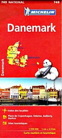
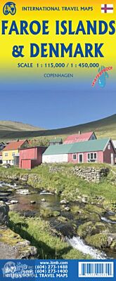
ITM - Carte du Danemark et des îles Féroés
| Destination | Europe |
|---|---|
| Pays / Région | Danemark, Iles Féroés |
| Edition, collection | I.T.M (International Travel maps) |
Une carte recto/verso avec, d'un côté le Danemark au 1/450.000ème (1 cm = 4.50 km) et, de l'autre, les îles Féroés au 1/115.000ème (1 cm = 1.15 km)
Détails de l'article
Voici comment l'éditeur présente ce titre sur son site :
Denmark’s Faroe Islands are one of Europe’s hidden treasures. This small archipelago is situated in the far north of the Atlantic, between Iceland and the European mainland. Several months ago, Lan and I visited these remote islands, which aren’t particularly easy to reach, and discovered that the Faroes hosts about 20,000 tourists per year. That enticed us to make a map of the Faroes. The islands are normally reached by air or ferry from Denmark or Iceland, and by the occasional cruise ship that makes the effort to stop by. The islands are quite modern and up-to-date, with an amazing road network that includes the longest undersea road tunnel in Europe; in fact, they have several long undersea roadway tunnels joining together most of the islands. They also have an excellent bus system joining Torshavn (the capital) to all parts of the country, with, and I love this, a helicopter network providing service to outlying islands, as well as a ferry service to the southernmost island of Suduroy. This really is a very nice travel destination! We rented a car and driver to explore and had a wonderful time discovering a part of the world relatively little visited. We had no problem coming up with an extensive list of Top Attractions. The reverse side of the sheet of waterproof paper is a detailed map of Denmark, simply because the Faroes ARE Danish and the easiest jump-off point to reach the Faroes is from Denmark. The country, although not large even by European thinking, is very developed and sophisticated. It is connected to continental Europe by a fairly narrow peninsula just north of Flensburg, Germany, and consists of a series of islands mostly joined together by bridges, motorways, and train lines. Ferries to the Faroes leave from the northern port city of Hanstholm. An inset map of central Copenhagen is included.
Legend Includes:
Roads by classification, Rivers and Lakes, National Park, Airports, Points of Interests, Highways, Main Roads, Zoos, Fishing, and much more...
(Source : ITM)