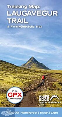
Knife Edge Outdoor Guidebooks -Carte de randonnées - Trekking Iceland's Laugavegur Trail (& Fimmvörðuháls Trail)
| Destination | Europe |
|---|---|
| Pays / Région | Islande |
| Edition, collection | Knife Edge - Outdoor Guidebooks |
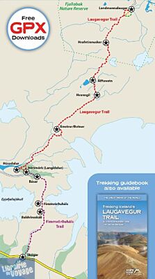
Carte imperméable au 1/40.000ème (soit 1 cm = 400m) pour réaliser le sentier de Laugavegur (et le sentier de Fimmvörðuháls) en Islande. Comprend des téléchargements GPX gratuits pour les sentiers ainsi que de nombreuses informations pratiques (refuges, sites de géothermie, campings,..). Légende en anglais.
Détails de l'article
Voici comment l'éditeur présente ce titre sur son site :
Waterproof sheet map for Iceland's Laugavegur Trail (& Fimmvörðuháls Trail): 1:40,000. Includes free GPX downloads for the trails.
The definitive map to Iceland’s two best trails: larger scale and more detail than any other map. Made specifically for the treks by Knife Edge Outdoor Guidebooks.
Waterproof
Free GPX downloads
Tough
Lightweight
All huts/campsites are marked
Information on distances, times and altitude gain/loss between huts/campsites
Hot springs and fumaroles are marked
The Laugavegur Trail is one of the world's most beautiful and aspirational treks. It leads you into the heart of Iceland’s unique ice-capped, volcanic terrain. Experience spectacular and unusual landscapes, the likes of which you will not find anywhere else on the planet. Impressive volcanic peaks are a constant companion and steam gushes from the ground. This is Iceland at its best and it will be an adventure that you will never forget
(Source : Knife Edge Outdoor Guidebooks)

